
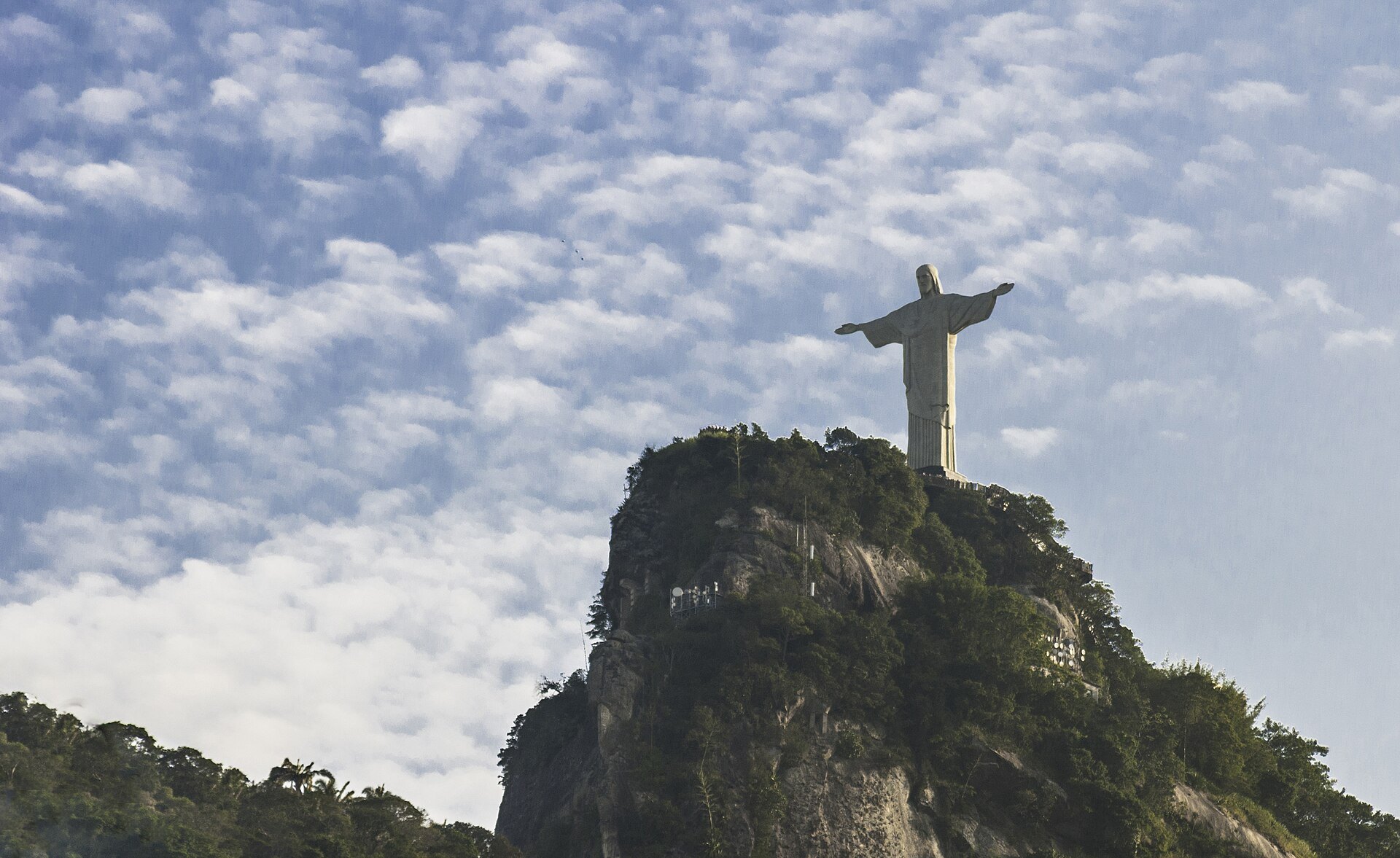
Most visitors to Rio de Janeiro see the forest without noticing it. It is the green wall behind Copacabana and Ipanema, the mountain the Christ the Redeemer statue stands on, the backdrop to every postcard of the bay. Tijuca National Park covers roughly 3,900 hectares of that mountain rainforest inside the city limits, which makes it one of the largest urban forests in the world, and it holds some of the best short mountain hikes we have done anywhere. You can leave a beach hotel after breakfast and be on a 1,000-metre summit in rainforest by lunchtime.
A forest that was planted
The surprising thing about Tijuca is that it is not virgin forest. By the early nineteenth century the hills above Rio had been cleared for coffee and sugar plantations, and the springs that supplied the city’s drinking water began to fail. In 1861 the imperial government ordered the hills replanted. Under the direction of an army officer named Manuel Gomes Archer, a small crew, most of them enslaved men whose names are only partly recorded, planted more than 100,000 native seedlings over about thirteen years. The forest that grew back is now mature Atlantic rainforest, home to capuchin monkeys, coatis, sloths, toucans and hundreds of bird species. The park was created in 1961 and is divided into sectors: the Floresta sector around Alto da Boa Vista, the Serra da Carioca sector with Corcovado, and the Pedra Bonita and Pedra da Gavea sector above Sao Conrado.
Pico da Tijuca, the high point
At 1,021 metres, Pico da Tijuca is the highest summit in the park and the second highest in the city. The trail starts at the Bom Retiro parking area in the Floresta sector and climbs steadily for about three kilometres through dense forest on a broad, well-marked path, with a couple of streams and viewpoints along the way. The final stretch is a stone staircase of 117 steps cut into the rock in 1920 for a visit by the King of the Belgians, with a handrail that you will be glad of in the wet. Allow about an hour and a half up and an hour down. From the top the whole city spreads out: Guanabara Bay, the Sugarloaf, the long curve of the beaches and the lagoon, and to the west the Pedra da Gavea and the ocean. Go early for clear air; by early afternoon the summit is often in cloud. The trail is not technical, but the humidity makes it feel longer than the map suggests, so carry more water than you think you need.
Pedra Bonita and the hang-gliders
Pedra Bonita is a granite dome of 696 metres above Sao Conrado, and it is the easiest big view in the park. A rough road climbs from the Estrada das Canoas to a small parking area, and from there a trail of about 1.5 kilometres reaches the summit in forty minutes. The top is a broad slab of rock with a hang-gliding and paragliding ramp on the edge, and watching pilots run off the platform and float down to the beach is half the fun. Beside it stands the Pedra da Gavea, 842 metres, a far more serious climb with a steep rock section that requires a guide or real scrambling experience. If you only have one afternoon and modest legs, Pedra Bonita is the one.
Cascatinha Taunay and the Floresta sector
The main entrance to the Floresta sector at Alto da Boa Vista brings you almost immediately to the Cascatinha Taunay, a waterfall of about 30 metres that drops over a granite face into a pool surrounded by tree ferns. It is the most photographed spot in the park and it is a five-minute walk from the road. Beyond it, a network of paved and unpaved lanes leads to the old Mayrink chapel, picnic grounds and a series of smaller trails, including the paths to the Pico da Tijuca and to the viewpoints of the Excelsior and the Mesa do Imperador. This sector is where local families come on weekends, and it is the safest and best-serviced part of the forest.
Corcovado and Christ the Redeemer
The Corcovado is a separate peak of 710 metres in the Serra da Carioca sector, and its 30-metre statue of Christ the Redeemer, completed in 1931, is the most visited place in the park. Most people go up by the cog railway from Cosme Velho, which has run since 1884, or by official vans from the Paineiras visitor centre. There is also a hiking trail from Parque Lage in the Jardim Botanico district that reaches the top in about two hours, steep and humid but through beautiful forest. Robberies have been reported on this trail in the past, so we walk it early, in a group, and without valuables, and we check with park staff at Parque Lage on the day.
Getting there, safety and the best months
The Floresta sector is easiest to reach by taxi or ride-hail to Alto da Boa Vista, about 30 to 40 minutes from the beach districts depending on traffic, or by bus from the city centre. There is no entry fee for the forest and vehicle gates open in the morning and close in the late afternoon; ask at the gate for the current hours, because they change. Bring at least two litres of water per person, sun protection and insect repellent, and wear shoes with grip, since the granite is slick when wet. Hike with at least one companion, keep phones and cameras out of sight on the quieter trails, and stay on the marked paths. The mountain weather turns fast, and afternoon thunderstorms in summer arrive with little warning.
The dry season from May to September is the best time: cooler, clearer and with far fewer storms. Summer, from December to March, is hot and humid with heavy afternoon rain, and the trails become streams. Weekdays are quieter than weekends in every sector. However you do it, do not leave Rio without a walk in the forest that the city planted for itself a century and a half ago; it is the greenest thing about a very green city.